The Red Atlas
How the Soviet Union Secretly Mapped the World
9780226389578
9780226389608
The Red Atlas
How the Soviet Union Secretly Mapped the World
Publication supported by the Neil Harris Endowment Fund
Nearly thirty years after the end of the Cold War, its legacy and the accompanying Russian-American tension continues to loom large. Russia’s access to detailed information on the United States and its allies may not seem so shocking in this day of data clouds and leaks, but long before we had satellite imagery of any neighborhood at a finger’s reach, the amount the Soviet government knew about your family’s city, street, and even your home would astonish you. Revealing how this was possible, The Red Atlas is the never-before-told story of the most comprehensive mapping endeavor in history and the surprising maps that resulted.
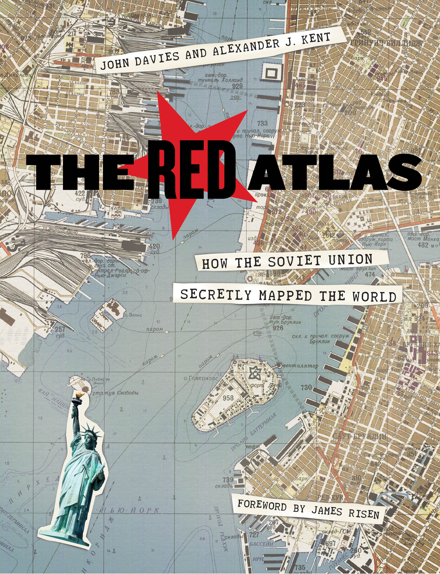
From 1950 to 1990, the Soviet Army conducted a global topographic mapping program, creating large-scale maps for much of the world that included a diversity of detail that would have supported a full range of military planning. For big cities like New York, DC, and London to towns like Pontiac, MI and Galveston, TX, the Soviets gathered enough information to create street-level maps. What they chose to include on these maps can seem obvious like locations of factories and ports, or more surprising, such as building heights, road widths, and bridge capacities. Some of the detail suggests early satellite technology, while other specifics, like detailed depictions of depths and channels around rivers and harbors, could only have been gained by actual Soviet feet on the ground. The Red Atlas includes over 350 extracts from these incredible Cold War maps, exploring their provenance and cartographic techniques as well as what they can tell us about their makers and the Soviet initiatives that were going on all around us.
A fantastic historical document of an era that sometimes seems less distant, The Red Atlas offers an uncanny view of the world through the eyes of Soviet strategists and spies.
272 pages | 282 color plates | 7 x 9 | © 2017
Geography: Cartography, Cultural and Historical Geography, Social and Political Geography
History: General History, Military History
Reviews
Table of Contents
Foreword by James Risen
Note to Readers
Introduction
Why this book is a detective story
1 War and Peace
The background of the story—from Napoleon’s march on Moscow to the collapse of the Soviet Union
2 Capturing the World—on Paper
Describing the style, content, and symbology of the Red Army’s maps of the world
3 Plots and Plans
The overt and covert methods of the Soviet cartographers
4 Resurrection
The discovery of the maps after the fall of the Soviet Union and their continuing significance today
Acknowledgments
Appendix 1 Examples of Maps of Various Series and Scales
Appendix 2 References and Resources
Appendix 3 Translation of Typical City Plan Spravka
Appendix 4 Translation of Typical Topographic Map Spravka
Appendix 5 Symbols and Annotation
Appendix 6 Glossary of Common Terms and Abbreviations
Appendix 7 Print Codes
Appendix 8 Secrecy and Control
General Index
Place-Names Index